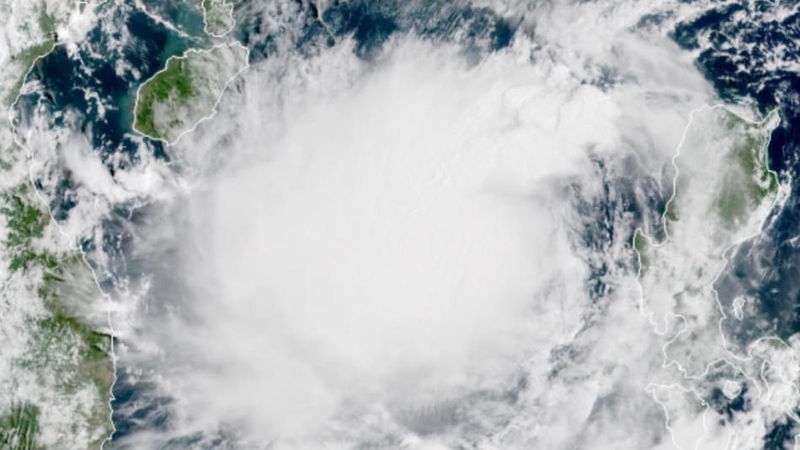
The Meteorological Department Thursday issued an urgent warning to residents of many provinces to brace for heavy rains as tropical storm Podul makes its influence felt.
In its warning issued at 5am, the department said Podul a category 3 tropical storm, was centred at latitude 17.3 degrees north, longitude 112.3 degrees east at 4am with maximum sustained winds of 80 km/hr.
The department said the storm was moving west through Hainan to the Gulf of Tonkin at a speed of about 25 km/hr and would make landfall over upper Vietnam by Friday.
The storm was likely to bring torrential rain and strong winds to Northeast Thailand from Thursday before shifting to North, the East and the South (west coast).
The areas most likely to be affected are as follows:
August 29, heavy to very heavy rain
Northeast: Bueng Kan, Nong Khai, Udon Thani, Nong Bua Lamphu, Nakhon Phanom, Sakon Nakhon, Mukdahan, Anat Charoen, Yasothon and Ubon Ratchathani
Central: Kanchanaburi and Ratchaburi
East: Prachinburi, Sa Kaeo, Chanthaburi and Trat.
South (west coast): Ranong, Phang Nga, Phuket, Krabi, Trang and Satun
August 30-31, heavy to very heavy rain:
North: Chiang Rai, Phayao, Phrae, Nan, Lampang, Tak, Sukhothai, Kamphaeng Phet, Uttaradit, Phitsanulok, Phichit and Phetchabun.
Northeast: Loei, Nong Khai, Nong Bua Lamphu, Udon Thani, Bueng Kan, Nakhon Phanom, Sakon Nakhon, Chaiyaphum, Khon Kaen, Maha Sarakham, Kalasin, Roi Et, Yasothon, Amnat Charoen and Ubon Ratchathani
Central: Kanchanaburi, Uthai Thani, Suphan Buri, Chai Nat and Nakhon Sawan
East: Nakhon Nayok, Prachinburi, Chachoengsao, Sa Kaeo, Chon Buri, Rayong, Chanthaburi and Trat.
South: Phetchaburi, Prachuap Khiri Khan, Chumphon, Ranong, Phang Nga, Phuket, Krabi, Trang and Satun
September 1, heavy rain:
North: Mae Hong Son, Chiang Mai, Lamphun, Lampang, Tak, Sukhothai and Kamphaeng Phet
Central: Ratchaburi, Kanchanaburi, Uthai Thani, Suphan Buri and Chai Nat
East: Chonburi, Rayong, Chanthaburi and Trat
South: Phetchaburi, Ranong, Phang Nga and Phuket.


